The Willow Lane complex
near Tamworth
As the first local BOAT I drove this one is close to my
heart.
Just over 2 km long, it varies in surface from a wide,
hard, well and maintained stone to rather narrow and boggy.
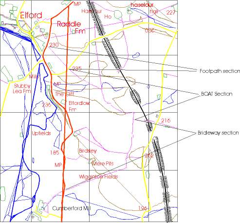
The attached map is based on an accumulation of data from
various Ordnance Survey maps.
Starting at the Elford end we have a wide turn in onto
a firm stone base which leads downhill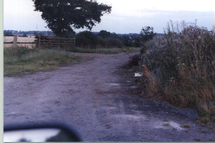 To
our right is a typical farm refuse tip, with the remnants of many bonfires,
fridges, and the occasional three piece suite, but since the road is very
wide, this presents no problem.
To
our right is a typical farm refuse tip, with the remnants of many bonfires,
fridges, and the occasional three piece suite, but since the road is very
wide, this presents no problem.
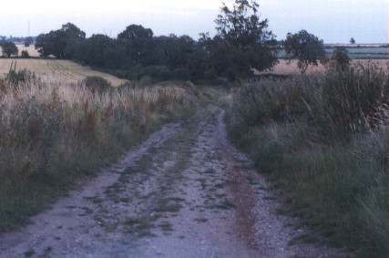 The
route continues down hill, the worn surface is generally in good condition,
so good that it can be used by young couples seeking a quiet spot to study
each other's anatomy...
The
route continues down hill, the worn surface is generally in good condition,
so good that it can be used by young couples seeking a quiet spot to study
each other's anatomy...
At the bottom of the hill there is a bad few yards, where
farm traffic has broken up the surface, and we cross the spring line -
I'm always to busy keeping forward momentum up through the resultant mire
after rain, or picking my way over the hard lumps of clay to have any pictures
of this bit!
 The
lane now becomes a pair of tyre tracks in the grass, between various bushes
and trees. This can be a bit boggy when wet, but the underlying surface
of the original road is there, hard stone, buried by about 6 inches of
wash off from the fields around. Farm refuse tips continue along
much of the usable track, which is limited to about 7 feet in width.
This is a great shame because the road was about 20 to 30 feet wide in
the past.
The
lane now becomes a pair of tyre tracks in the grass, between various bushes
and trees. This can be a bit boggy when wet, but the underlying surface
of the original road is there, hard stone, buried by about 6 inches of
wash off from the fields around. Farm refuse tips continue along
much of the usable track, which is limited to about 7 feet in width.
This is a great shame because the road was about 20 to 30 feet wide in
the past.
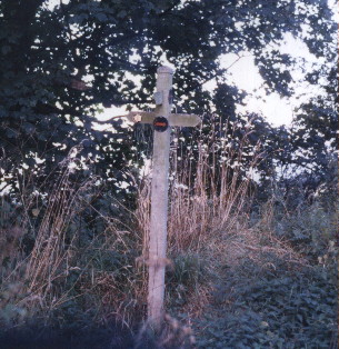 About
half way along the BOAT section we have a rare sight, a way marker, showing
the BOAT turning to the right, with a footpath leading off to the left.
Note that like many BOAT way marks this is not a County Council provided
sign, but one provided by some charitable individual. With the sanction
of the County Council such way marks provide assistance to all users of
all rights of way.
About
half way along the BOAT section we have a rare sight, a way marker, showing
the BOAT turning to the right, with a footpath leading off to the left.
Note that like many BOAT way marks this is not a County Council provided
sign, but one provided by some charitable individual. With the sanction
of the County Council such way marks provide assistance to all users of
all rights of way.
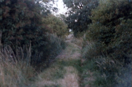
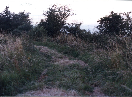 We
are now coming to the end of the BOAT section, to our left the main line
between Birmingham and Derby races past, ahead is the bit that was classified
under the 1968 Highways act as bridleway, but probably still has vehicular
rights. The railway is crossed on what Staffordshire call a 'County
road'. This is the view up the bridleway, leading eventually to the
mill at Cumberford.
We
are now coming to the end of the BOAT section, to our left the main line
between Birmingham and Derby races past, ahead is the bit that was classified
under the 1968 Highways act as bridleway, but probably still has vehicular
rights. The railway is crossed on what Staffordshire call a 'County
road'. This is the view up the bridleway, leading eventually to the
mill at Cumberford.
Back to Rights of way